
Pilots and passengers alike recognize that clouds are bumpy, even on otherwise smooth flying days. Sometimes it appears that the type of cloud itself is even irrelevant to the relative smoothness or bumpiness of a given cloud. Pilots benefit from being able to predict the presence of turbulence within a given cloud, so why are clouds turbulent, and what kinds of clouds are likely to be turbulent?
Clouds are often bumpy because they are visual indications of unstable, mixing air and changing atmospheric conditions. The cloud itself indicates a region where the temperature has decreased below the dew point because of some thermodynamic or mechanical disturbance within the atmosphere.
Some clouds are (much) more turbulent than others, and in this post, we’ll uncover why that is so.
What Causes Turbulence?
Removing clouds from the discussion, it is helpful to examine what causes turbulence. Fundamentally, turbulence is unstable air, and this instability is caused by mechanical or thermodynamic means.
To begin, consider first the thermodynamic causes of turbulence, namely convection.
Convective Turbulence
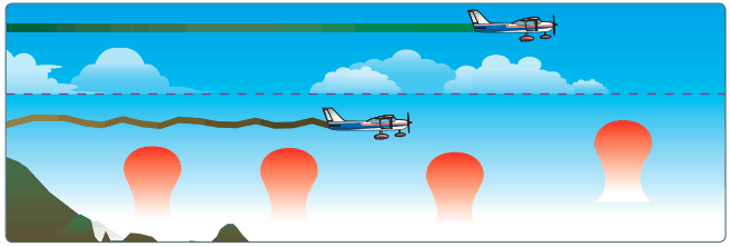
To simplify, convection is a thermal, the same ones used by glider pilots to stay aloft over flat ground during warm summer days. Thermals are localized areas of warmer, rising air, usually surrounded by corresponding cooler, sinking air (also called “lift” and “sink” by glider pilots).
As aircraft fly through these areas of lift and sink two things occur, first the angle of attack changes suddenly causing the total lift to change, and the aircraft physically is moved by the momentum of the surrounding air. Pilots and passengers sense this as turbulence as the aircraft abruptly experiences flight path changes.
Source: Figure 12-12 of the Pilot’s Handbook of Aeronautical Knowledge
Convective turbulence is the result of surface heating on the ground.
Pilots and passengers experience this on warm afternoons or even on cool days with plenty of sunlight to heat the Earth’s surface, but little wind to reduce the strength of thermals that form.
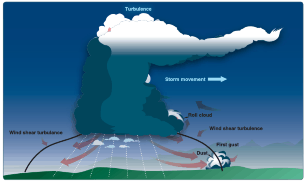
The other prominent form of “thermodynamic” turbulence is the boundary between air masses, known as frontal boundaries.
In these situations, two air masses of differing temperature merge and push against one another. This mixing action results in unstable air in a range of complex ways, but for the purposes of this discussion, knowing that frontal boundaries often result in unstable, turbulent air is sufficient.
Now consider “mechanical” causes of turbulence.
Mechanical Turbulence
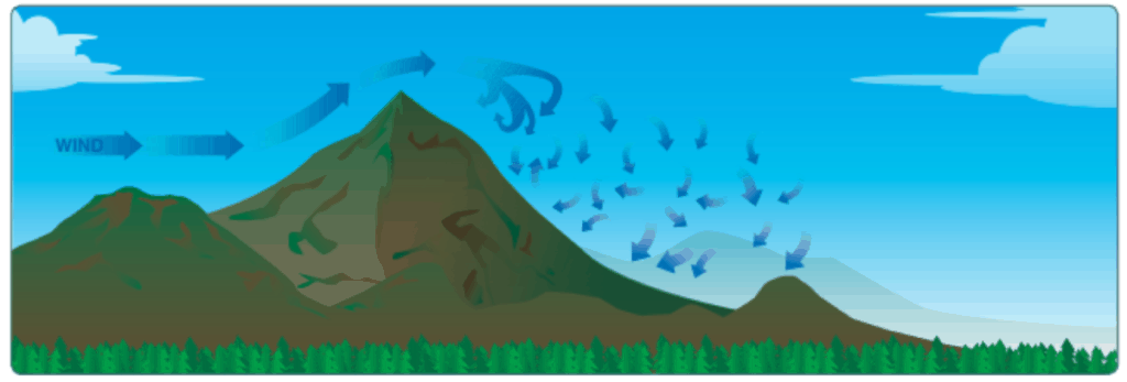
Mechanical turbulence can result from a range of situations, but the commonly recognized cause are mountains or large ridges on windy days.
Source: Figure 12-16 of the Pilots Handbook of Aeronautical Knowledge
Visualize the air flowing over the mountain as water flowing over a boulder in a stream, and it becomes apparent what the air quality on downwind side of the mountain will be. Other sources of mechanical turbulence include strong low-level wind gradients, buildings, wind shear and a host of other reasons.

Source: Figure 12-15 of the Pilots Handbook of Aeronautical Knowledge
Examining both ‘thermodynamic” and “mechanical” turbulence, it is apparent that turbulence is linked to the mixing of air masses with different properties. Those dissimilar properties may be temperature, velocity, pressure, or a combination of these factors.
The more dramatic the relative differences of these properties and the more abrupt the transition between air masses, the stronger the expected level of turbulence.
When and Where Do Turbulent Clouds Form?
Remember for a moment that clouds are localized zones of saturated air, meaning the temperature of the air is below the dewpoint. Applying this knowledge to the understanding of turbulence as a result of mixing air masses, turbulent clouds should be expected where this mixing action drops the air temperature below the dew point.
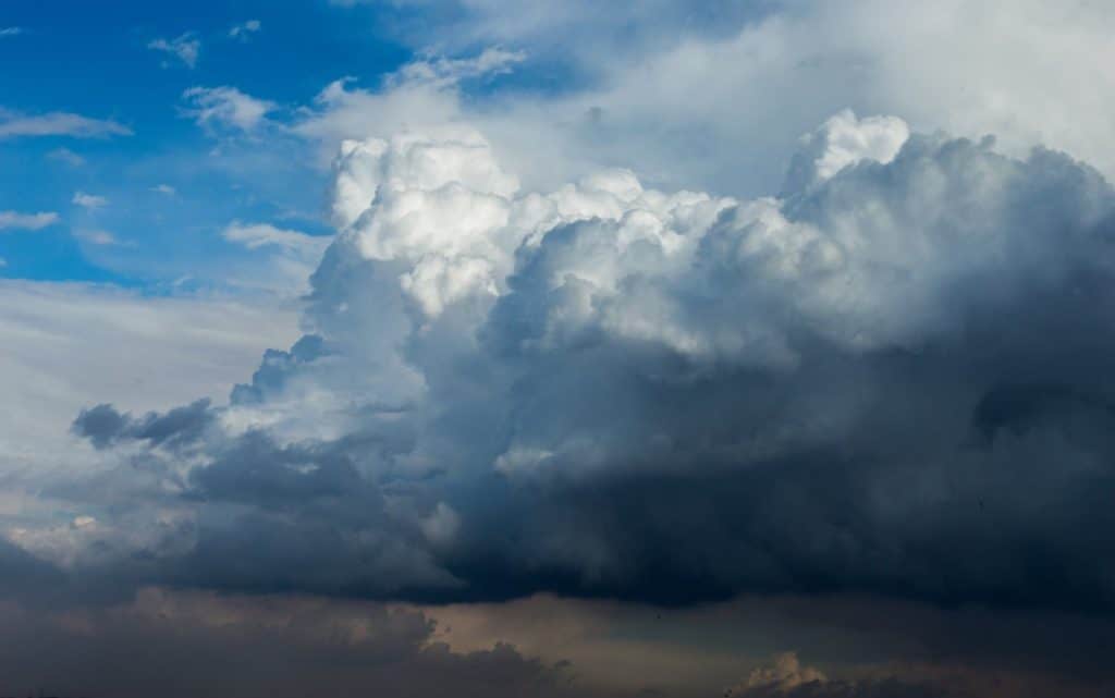
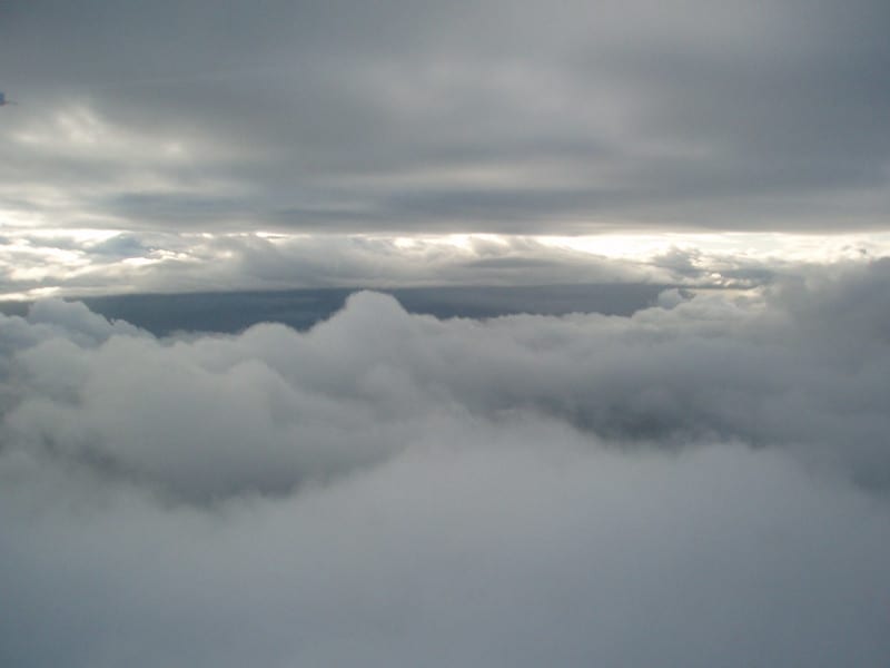
The most dramatic example of this principal would be cumulonimbus clouds, or thunderstorms. (See “Why are cumulonimbus clouds dangerous?” for a discussion of the hazards presented by cumulonimbus clouds!)
Thunderstorms are a complex but fundamentally convective phenomenon. Thunderstorms start as thermals, strong thermals, but thermals all the same. Warm air rises carrying moisture and dust along with it, cooling as it increases in altitude.
Eventually this warm air cools sufficiently to reach the dewpoint, where the associated moisture will condense around any airborne particulate to form a cloud, typically the white, fluffy cumulus clouds associated with summer afternoons.
With sufficiently strong lifting action, these cumulus clouds form towering cumulus and eventually the cumulonimbus and associated thunderstorm.
Source: Figure 12-29 from the Pilots Handbook of Aeronautical Knowledge
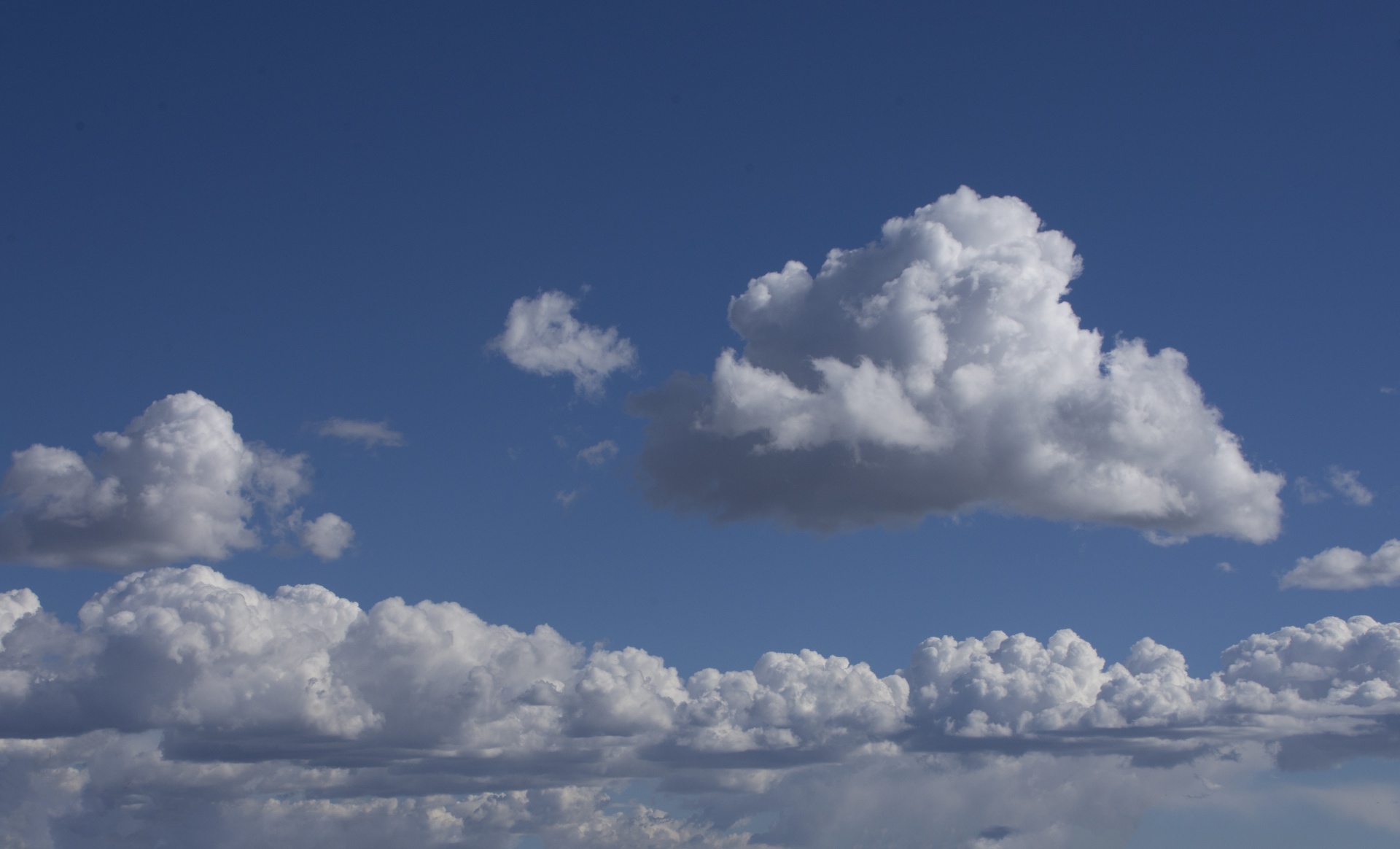
Cumulus clouds and their variants are the “classic” examples of bumpy clouds because they tend to appear on days that appear to be good for flying and their physical appearance is friendly.
IFR pilots know to avoid flying through these clouds if possible to not get tossed and bumped during the flight.
Thunderstorms and fair-weather cumulus clouds make for excellent warnings of convective turbulence both in and around the cloud, but pilots should expect to encounter turbulent conditions within clouds at frontal boundaries or anywhere where there is a sudden change in weather conditions.
Convection and frontal activity are not the only causes of cloud formation, revisiting the “mechanical” sources of turbulence provides some stunning examples of turbulent clouds.
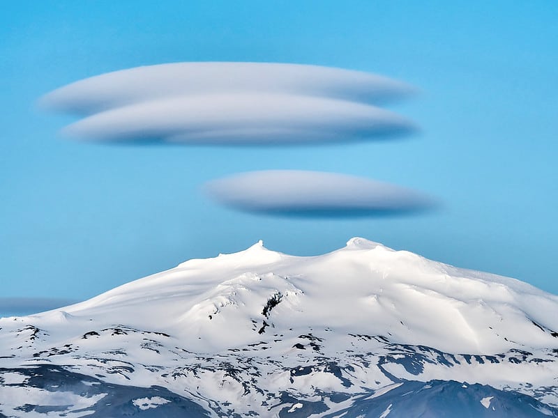
Cloud formations directly downwind or above large terrain features will be turbulent.
As air flows around large surface features, wind velocity tends to increase, and in turn pressure and temperature decrease, causing a cloud to form. The classic examples of these formations include Lenticular clouds and Rotor clouds (pictured below).
Clouds can serve as useful signposts that mark the location of turbulence, or even hazardous weather conditions. Clouds show areas of unstable, mixing air that is somehow different from the surrounding air due to temperature, velocity, pressure or a combination of all three. This divergence from surrounding air is the source of the associated turbulent conditions.
What Types of Clouds Are Most Likely to be Turbulent?
As an example, the following list provides a useful set of examples of the types of clouds that are most likely to reveal turbulent conditions, along with some of the associated weather conditions.
Cumulus (of all varieties)
- Warm weather, with moderate or high humidity
- Where a temperature inversion is present, expect turbulent conditions below the bases and smooth air above the bases while outside the clouds
Cumulonimbus

- Thunderstorms and their associated cloud formations.
- High humidity and warm temperatures
- Frontal boundaries and squall lines during summer months
Stratus
- Frontal boundaries
- Heavy precipitation, either as rain or snow
Rotor Clouds

- Strong winds at or above large terrain features.
- Located downwind of mountains ranges or large ridges and below or at the terrain height.
Lenticular Clouds
- Strong winds at or above large terrain features.
- Located above the terrain feature and may reoccur downwind of the feature.
- Surface winds well below the peak may be calm.
Are All Clouds Turbulent?
Not all cloud formations will be turbulent. Clouds may form in stable air that is relatively free of disturbance.
Turbulent conditions are associated with mixing air, but where a uniform air mass is present, little mixing occurs, but cloud formation is still possible.
Post frontal conditions associated with a cold front pushing beneath a warm front, or foggy conditions are situations where stable, saturated air will form clouds that are relatively free of turbulence.
Constant temperatures, low lapse rates and low wind are all excellent clues that any clouds that are present are likely to have little or no turbulence present, as these conditions are indicative of stable air. Stable air is smooth air, clouds or no clouds.
Conclusion
Clouds are often turbulent because they form where unstable air cools below the dew point. Turbulence is generally the result of instability with in the atmosphere and, as a result, clouds are useful for revealing the presence of turbulent air.
Convection, frontal boundaries and high winds are indications that clouds that do form will be turbulent. Clouds that form in stable, calm atmospheric conditions are less likely to hide turbulent conditions. Pilots can use the presence of clouds to predict where turbulence is likely to form and plan to avoid those areas for safety and passenger comfort.


